
|
HICKAHALA CREEK NR SENATOBIA, Tate County, Mississippi, Hydrologic Unit 08030204, Drainage area: 121 square miles, Datum of gage: 233.02 feet above NGVD29 |
|
Spatial Data |
|
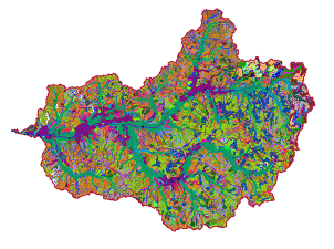
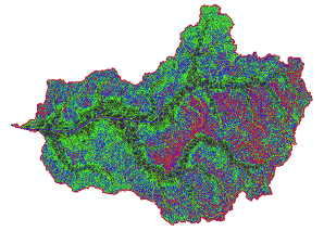
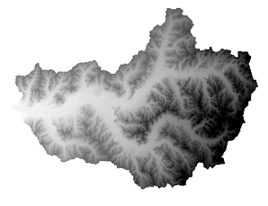
We incorporated spatial analysis using Geological Information System (GIS) techniques and developed a code (SWATpy) in Python programming language to semi-automate and perform the analyses. The code is under development to fully automate the entire modeling process. Python 3 and ArcSWAT version 2012.10.19 (SWAT v2012, rev.667) were used. Soil, Land use, and elevation data (Digital Elevation Model (DEM)) are in a gridded format. US soil database includes two types of soil data: State Soil Geographic Database (STATSGO) and gridded Soil Survey Geographic Database (gSSURGO). The former is in built in SWAT soil database and the former were derived from United States Department of Agriculture (USDA). Sensitivity analysis was carried out based on observed discharge. Due to greater detail and better performance of gSSURGO, it was selected for the modeling. The UCS soil map has more than 250 soil classes. The elevation and land use data sets were derived from US Geological Survey (USGS) and Multi-Resolution Land Characteristics (MRLC) Consortiums respectively. The Digital Elevation Model (DEM) of 1/3 arc-second (approximately 10m resolution for the study area) was used. It is a 3DEP (3D Elevation Program) map. The data extent is 1x1 degree. The land use data set is NLCD2016 in 30 m resolution; and the corresponding 2001-2006 lookup table weas used. |